
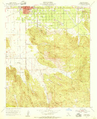
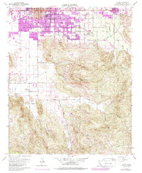
1953 Map of Hemet
USGS Topo · Published 1975About this map
Hemet serves as the focal point of this mid-century landscape, where the town's expansion meets the sprawling agricultural and natural terrain of the San Jacinto Valley. The rail connection via the Atchison Topeka and Santa Fe underscores the historical importance of transportation in this region, linking the interior valley to wider markets. South of the city, the land rises sharply into the Santa Rosa Hills, punctuated by landmarks like the Ramona Bowl and Hemet Butte.
Find a feature on this map
32 named features on this map. Tap any name to fly to it.
Don’t see what you’re looking for? This feature index may not catch every label — zoom into the map to look around manually.
Map Details
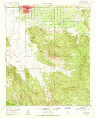
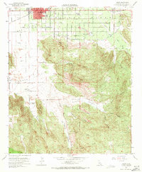
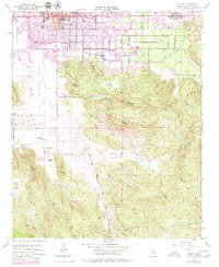
Editions of this 1953 Hemet Map
6 editions found
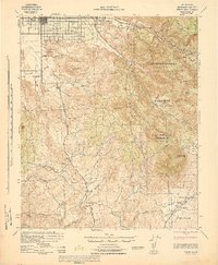
Other maps of this area

1901 · Southern California Sheet No. 1
USGS Topo · 1:250,000

1901 · San Jacinto
USGS Topo · 1:125,000

1901 · Elsinore
USGS Topo · 1:125,000

1904 · Southern California Sheet No. 1
USGS Topo · 1:250,000

1942 · Banning
USGS Topo · 1:62,500

1942 · Hemet
USGS Topo · 1:62,500

1942 · Murrieta
USGS Topo · 1:62,500

1942 · Perris
USGS Topo · 1:62,500

1943 · Perris
USGS Topo · 1:62,500
1943 · Hemet
USGS Topo · 1:62,500