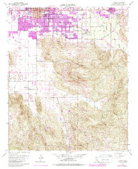
1953 Map of Hemet
USGS Topo · Published 1979About this map
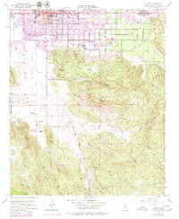
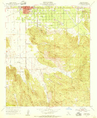
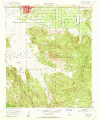
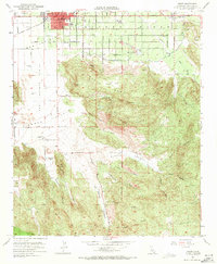
The San Jacinto Valley serves as a stark dividing line between the growing urban grid of Hemet and the steep, complex terrain of the Santa Rosa Hills. This 1953 survey, updated with late-1970s land use data, shows the expansion of residential streets along Florida Ave and Stetson Ave, while the southeastern corner of the valley remains dominated by working landscapes like the Searl Ranch and Mission Ranch. Culturally significant landmarks such as the Ramona Bowl are positioned where the valley floor meets the foothills, overlooking a landscape defined by seasonal watercourses like Bautista Creek and Little Lake. Further south, the map details the rugged drainage systems of Cactus Valley and St Johns Canyon, highlighting how geography limited early development primarily to the northern basin and the rail corridor of the Atchison Topeka and Santa Fe railroad.
Find a feature on this map
47 named features on this map. Tap any name to fly to it.
Don’t see what you’re looking for? This feature index may not catch every label — zoom into the map to look around manually.
Map Details
Editions of this 1953 Hemet Map
6 editions found

Other maps of this area

1901 · Southern California Sheet No. 1
USGS Topo · 1:250,000

1901 · San Jacinto
USGS Topo · 1:125,000

1901 · Elsinore
USGS Topo · 1:125,000

1904 · Southern California Sheet No. 1
USGS Topo · 1:250,000

1942 · Banning
USGS Topo · 1:62,500

1942 · Hemet
USGS Topo · 1:62,500

1942 · Murrieta
USGS Topo · 1:62,500

1942 · Perris
USGS Topo · 1:62,500

1943 · Perris
USGS Topo · 1:62,500
1943 · Hemet
USGS Topo · 1:62,500