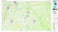
1986 Map of Henderson
USGS Topo · Published 1986About this map
The Sabine River cuts through the heart of this East Texas landscape, marking the shift between the growing oil and timber centers of Longview and Henderson. In the mid-1980s, the region was defined by a mix of intensive industrial use and recreational development. Large Strip Mine operations are prominent between Tatum and Beckville, while the waters of Martin Lake and Murvaul Lake provide significant geographic focal points.
Find a feature on this map
171 named features on this map. Tap any name to fly to it.
Don’t see what you’re looking for? This feature index may not catch every label — zoom into the map to look around manually.
Map Details
Editions of this 1986 Henderson Map
2 editions found
Other maps of this area

1935 · Henderson
USGS Topo · 1:48,000

1936 · Kilgore
USGS Topo · 1:48,000

1937 · Troupe
USGS Topo · 1:48,000

1938 · Winona
USGS Topo · 1:48,000

1939 · Henderson
USGS Topo · 1:62,500

1940 · Kilgore
USGS Topo · 1:62,500

1943 · Troup
USGS Topo · 1:62,500

1943 · Winona
USGS Topo · 1:62,500

1943 · Waskom
USGS Topo · 1:62,500

1943 · Cushing
USGS Topo · 1:62,500