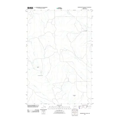
2011 Map of Hendrickson Coulee
USGS Topo · Published 2011About this map
Hendrickson Coulee defines the drainage patterns of this Prairie County landscape, where deep coulees and seasonal creek beds carve through the high plains of eastern Montana. The map illustrates a network of drainage systems including Dickoff Creek and Cottonwood Creek, which feed into larger watercourses like Bad Route Creek. To the south, the prominent Sheepshead Bluffs rise above the surrounding terrain, marking a distinct break in the topography. A sparsely populated area during the early 21st century, the sheet shows a basic infrastructure of rural routes such as Road 217 and Road 229, with the Bad Route Creek Bridge providing a critical crossing point in the northeast. This cartographic study preserves the alignment of local access roads like Tower Rd and Fallon Tower Rd as they served the remote cattle and ranching country of the region.
Find a feature on this map
15 named features on this map. Tap any name to fly to it.
Don’t see what you’re looking for? This feature index may not catch every label — zoom into the map to look around manually.
Map Details
Editions of this 2011 Hendrickson Coulee Map
This is the sole edition of this map. No revisions or reprints were ever made.
Other maps of this area

1953 · Miles City
USGS Topo · 1:250,000

1954 · Glendive
USGS Topo · 1:250,000

1957 · Miles City
USGS Topo · 1:250,000

1957 · Glendive
USGS Topo · 1:250,000

1958 · Miles City
USGS Topo · 1:250,000

1958 · Glendive
USGS Topo · 1:250,000

1966 · Fallon
USGS Topo · 1:24,000
1967 · Fallon NE
USGS Topo · 1:24,000

1972 · Hendrickson Coulee
USGS Topo · 1:24,000

1972 · Diamond G Creek
USGS Topo · 1:24,000