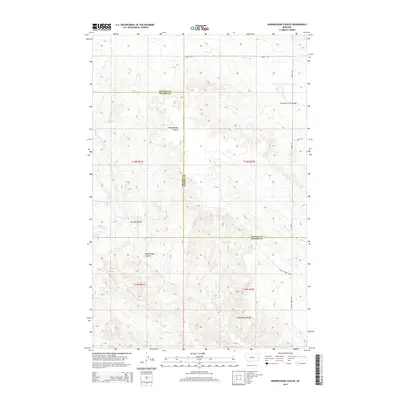
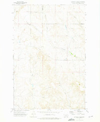
2014 Map of Hendrickson Coulee
USGS Topo · Published 2014About this map
Sheepshead Bluffs rises over a complex drainage network in this section of eastern Montana, where the terrain is defined by the shifting border of Dawson and Prairie Counties. The area is characterized by deep erosion patterns, notably the extensive Hendrickson Coulee and Dickoff Coulee. These features dictate the local geography, channeling seasonal water into streams such as Bad Route Cr and Cottonwood Cr. Human presence is mapped through a sparse network of county roads and essential infrastructure, including the Bad Route Creek Bridge and the path of Fallon Tower Rd. The map illustrates the intersection of Township and Range lines, marking out T14N R51E and T14N R52E, which remain primary reference points for land management in this cattle-ranching country.
Find a feature on this map
21 named features on this map. Tap any name to fly to it.
Don’t see what you’re looking for? This feature index may not catch every label — zoom into the map to look around manually.
Map Details
Editions of this 2014 Hendrickson Coulee Map
This is the sole edition of this map. No revisions or reprints were ever made.
Other maps of this area

1953 · Miles City
USGS Topo · 1:250,000

1954 · Glendive
USGS Topo · 1:250,000

1957 · Miles City
USGS Topo · 1:250,000

1957 · Glendive
USGS Topo · 1:250,000

1958 · Miles City
USGS Topo · 1:250,000

1958 · Glendive
USGS Topo · 1:250,000
1966 · Fallon
USGS Topo · 1:24,000
1967 · Fallon NE
USGS Topo · 1:24,000
1972 · Hendrickson Coulee
USGS Topo · 1:24,000
1972 · Diamond G Creek
USGS Topo · 1:24,000