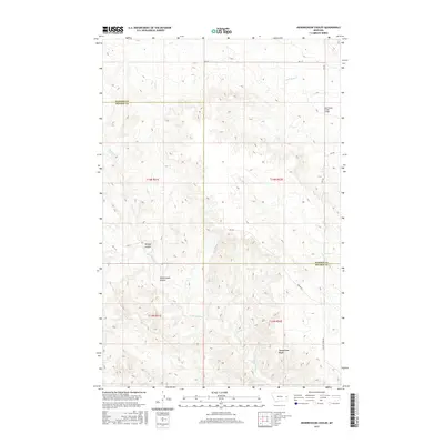
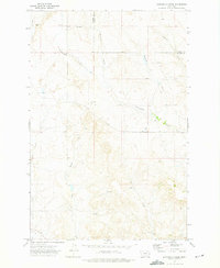
2017 Map of Hendrickson Coulee
USGS Topo · Published 2017About this map
Hendrickson Coulee characterizes the drainage patterns of this high plains borderland between Dawson and Prairie counties. The landscape is defined by its deep coulees and seasonal watercourses, including Dickoff Cr and Hatchet Cr, which cut through the elevation toward the Bad Route Cr drainage. At the southern end of the map, the Sheepshead Bluffs rise prominently above the surrounding terrain near the headwaters of Cameron Cr. This area remains largely defined by its rural road network, with routes like Tower Rd and Fallon Tower Rd providing access through the range townships. The infrastructure is minimal, marked primarily by the Bad Route Creek Bridge in the northeast, which serves as a vital crossing point in a region otherwise dominated by natural topographic features like Dickoff Coulee and Cottonwood Cr.
Find a feature on this map
21 named features on this map. Tap any name to fly to it.
Don’t see what you’re looking for? This feature index may not catch every label — zoom into the map to look around manually.
Map Details
Editions of this 2017 Hendrickson Coulee Map
This is the sole edition of this map. No revisions or reprints were ever made.
Other maps of this area

1953 · Miles City
USGS Topo · 1:250,000

1954 · Glendive
USGS Topo · 1:250,000

1957 · Miles City
USGS Topo · 1:250,000

1957 · Glendive
USGS Topo · 1:250,000

1958 · Miles City
USGS Topo · 1:250,000

1958 · Glendive
USGS Topo · 1:250,000
1966 · Fallon
USGS Topo · 1:24,000
1967 · Fallon NE
USGS Topo · 1:24,000
1972 · Hendrickson Coulee
USGS Topo · 1:24,000
1972 · Diamond G Creek
USGS Topo · 1:24,000