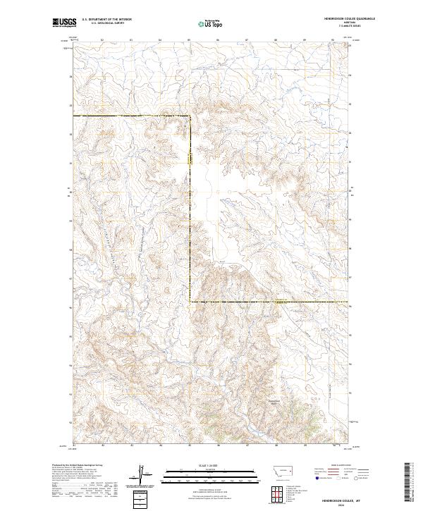
2024 Map of Hendrickson Coulee
USGS Topo · Published 2024About this map
Sheepshead Bluffs rises over a landscape defined by an intricate network of drainages and coulees along the border of Prairie and Dawson Counties. This high plains terrain is carved by the winding paths of Hendrickson Coulee and Dickoff Coulee, illustrating the erosional patterns typical of eastern Montana. The map documents the way water moves through this arid environment, with Bad Route Creek and Hatchet Creek flowing through the northern sections while Cottonwood Creek and Pine Creek dominate the south. Development is minimal, limited primarily to a sparse grid of gravel routes including Tower Rd and Fallon Tower Rd, which provide access across the township lines of t14n r51e and t13n r52e.
Find a feature on this map
20 named features on this map. Tap any name to fly to it.
Don’t see what you’re looking for? This feature index may not catch every label — zoom into the map to look around manually.
Map Details
Editions of this 2024 Hendrickson Coulee Map
This is the sole edition of this map. No revisions or reprints were ever made.
Other maps of this area

1953 · Miles City
USGS Topo · 1:250,000

1954 · Glendive
USGS Topo · 1:250,000

1957 · Miles City
USGS Topo · 1:250,000

1957 · Glendive
USGS Topo · 1:250,000

1958 · Miles City
USGS Topo · 1:250,000

1958 · Glendive
USGS Topo · 1:250,000

1966 · Fallon
USGS Topo · 1:24,000
1967 · Fallon NE
USGS Topo · 1:24,000

1972 · Hendrickson Coulee
USGS Topo · 1:24,000

1972 · Diamond G Creek
USGS Topo · 1:24,000