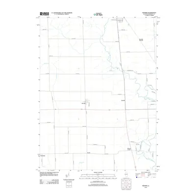
2012 Map of Henning
USGS Topo · Published 2012About this map
The N Fork Vermilion River carves a winding path through this corner of Vermilion County, defining a landscape of agricultural plots and small crossroads settlements. The village of Henning serves as a central point, situated along the intersection of Ross St and several key rural routes. This 2012 survey illustrates the enduring rural infrastructure of Illinois, where long-established names like Moores Corner, Rayville, and Vernal anchor the local geography even as larger transit patterns shift. To the north, Rossville Junction suggests a historical intersection of travel, while Lake DeRevey provides a notable break in the drainage patterns formed by Bean Cr and Windfall Cr. For those tracing family ties to the area, Gundy Cem and landmarks such as Manns Chapel Rd offer specific points of interest within this grid of country roads.
Find a feature on this map
52 named features on this map. Tap any name to fly to it.
Don’t see what you’re looking for? This feature index may not catch every label — zoom into the map to look around manually.
Map Details
Editions of this 2012 Henning Map
This is the sole edition of this map. No revisions or reprints were ever made.
Other maps of this area

1899 · Danville
USGS Topo · 1:62,500

1900 · Danville
USGS Topo · 1:62,500

1931 · Fithian
USGS Topo · 1:48,000

1933 · Hoopeston
USGS Topo · 1:48,000

1936 · Potomac
USGS Topo · 1:62,500

1938 · Hoopeston
USGS Topo · 1:62,500

1943 · Fithian
USGS Topo · 1:62,500

1948 · Danville NW
USGS Topo · 1:24,000

1950 · Danville NW
USGS Topo · 1:24,000

1950 · Danville NE
USGS Topo · 1:24,000