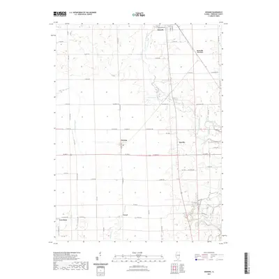
2021 Map of Henning
USGS Topo · Published 2021About this map
Rossville sits at the northern edge of this Vermilion County landscape, where the North Fork Vermilion River meanders southward through a patchwork of agricultural sections and rural settlements. The map highlights a series of small, interconnected communities such as Henning, Rayville, and Vernal, revealing a settlement pattern shaped by the local drainage systems and early transportation routes. Near Rossville Junction, the terrain transitions into the river valley, where the Middle Branch North Fork Vermilion River joins the main stem. Local history and genealogy interests are anchored by features like Gundy Cem and the quiet lakefront at Lake DeRevey, while the extensive network of drainage features like Bean Cr Ditch and Windfall Cr demonstrates the intensive land management required for Illinois prairie farming.
Find a feature on this map
46 named features on this map. Tap any name to fly to it.
Don’t see what you’re looking for? This feature index may not catch every label — zoom into the map to look around manually.
Map Details
Editions of this 2021 Henning Map
This is the sole edition of this map. No revisions or reprints were ever made.
Other maps of this area

1899 · Danville
USGS Topo · 1:62,500

1900 · Danville
USGS Topo · 1:62,500

1931 · Fithian
USGS Topo · 1:48,000

1933 · Hoopeston
USGS Topo · 1:48,000

1936 · Potomac
USGS Topo · 1:62,500

1938 · Hoopeston
USGS Topo · 1:62,500

1943 · Fithian
USGS Topo · 1:62,500

1948 · Danville NW
USGS Topo · 1:24,000

1950 · Danville NW
USGS Topo · 1:24,000

1950 · Danville NE
USGS Topo · 1:24,000