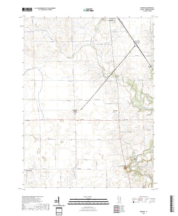
2024 Map of Henning
USGS Topo · Published 2024About this map
Rossville and Henning anchor this Vermilion County landscape, where the North Fork Vermilion River and its tributaries define the local geography. The area is characterized by a precise grid of agricultural roads, such as N 1300 East Rd and Rd 3000 N, which connect smaller locales like Rayville and the crossing at Rossville Junction. The drainage patterns are clearly marked by features such as Bean Creek Ditch and Windfall Creek, illustrating the extensive land management required for Illinois prairie farming.
Find a feature on this map
65 named features on this map. Tap any name to fly to it.
Don’t see what you’re looking for? This feature index may not catch every label — zoom into the map to look around manually.
Map Details
Editions of this 2024 Henning Map
This is the sole edition of this map. No revisions or reprints were ever made.
Other maps of this area

1899 · Danville
USGS Topo · 1:62,500

1900 · Danville
USGS Topo · 1:62,500

1931 · Fithian
USGS Topo · 1:48,000

1933 · Hoopeston
USGS Topo · 1:48,000

1936 · Potomac
USGS Topo · 1:62,500

1938 · Hoopeston
USGS Topo · 1:62,500

1943 · Fithian
USGS Topo · 1:62,500

1948 · Danville NW
USGS Topo · 1:24,000

1950 · Danville NW
USGS Topo · 1:24,000

1950 · Danville NE
USGS Topo · 1:24,000