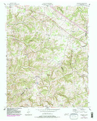
1957 Map of Henrietta
USGS Topo · Published 1983About this map
The County Home for the Indigent and a dense network of country churches and family cemeteries anchor this 1950s survey of the rolling terrain along the Montgomery and Cheatham County line. Small communities like Hickory Point and Henrietta serve as local hubs, connected by the historical path of the Clarksville Pike. The landscape is deeply carved by water, with Brush Creek and its tributaries such as Sorghum Branch and Reynolds Branch shaping the settlement patterns of the era. Genealogists will find a wealth of specific family landmarks, from the Hollis-Nanny Cem to the Albright Cem, alongside numerous spiritual centers including Waltons Chapel and Bethel Ch. The map illustrates a rural Tennessee society built upon small-scale agriculture and established family homesteads just before modern highway expansions altered the traditional road networks.
Find a feature on this map
39 named features on this map. Tap any name to fly to it.
Don’t see what you’re looking for? This feature index may not catch every label — zoom into the map to look around manually.
Map Details
Editions of this 1957 Henrietta Map
3 editions found
Other maps of this area

1944 · Clarksville
USGS Topo · 1:50,000

1951 · Clarksville
USGS Topo · 1:24,000

1956 · Nashville
USGS Topo · 1:250,000

1957 · Cheatham Dam
USGS Topo · 1:24,000

1957 · Adams
USGS Topo · 1:24,000

1957 · Pleasant View
USGS Topo · 1:24,000

1957 · Henrietta
USGS Topo · 1:24,000

1957 · Ashland City
USGS Topo · 1:24,000

1957 · Sango
USGS Topo · 1:24,000

1957 · Clarksville
USGS Topo · 1:24,000