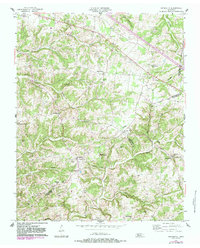
1957 Map of Henrietta
USGS Topo · Published 1983About this map
The rolling highlands of northern Tennessee are defined here by a dense network of family-named landmarks and rural congregations. The landscape transitions between Montgomery and Cheatham Counties, where small settlements like Henrietta and Thomasville anchor the community. A notable social landmark, the County Home for the Indigent, sits near the center of the sheet, reflecting mid-century social infrastructure.
Find a feature on this map
48 named features on this map. Tap any name to fly to it.
Don’t see what you’re looking for? This feature index may not catch every label — zoom into the map to look around manually.
Map Details
Editions of this 1957 Henrietta Map
3 editions found
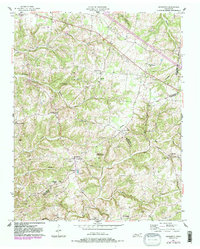
Other maps of this area

1944 · Clarksville
USGS Topo · 1:50,000

1951 · Clarksville
USGS Topo · 1:24,000

1956 · Nashville
USGS Topo · 1:250,000

1957 · Cheatham Dam
USGS Topo · 1:24,000

1957 · Adams
USGS Topo · 1:24,000

1957 · Pleasant View
USGS Topo · 1:24,000

1957 · Henrietta
USGS Topo · 1:24,000

1957 · Ashland City
USGS Topo · 1:24,000

1957 · Sango
USGS Topo · 1:24,000

1957 · Clarksville
USGS Topo · 1:24,000