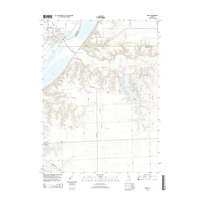
2015 Map of Henry
USGS Topo · Published 2015About this map
The Illinois River corridor anchors this portion of Marshall County, where the city of Henry occupies the western bank. The landscape transitions from the river's flat floodplains and backwater features like Whitney Lake and Billsbach Lake into a complex system of wooded ravines carved by Sandy Creek and Poole Cr. This 2015 survey reveals a significant concentration of small, family-named burial grounds dispersed throughout the rural landscape, including the Forbes Cem, Sawyer Cem, and the Jason and Broadus Cem. To the east, the development of residential lakeside communities is evident around Lake Wildwood and Lake Tanglewood. Longstanding rural routes like Stage Coach Rd and Tax School Rd provide a clear view of the historical transportation network that once connected these isolated farmsteads and cemeteries to the river port at Henry.
Find a feature on this map
71 named features on this map. Tap any name to fly to it.
Don’t see what you’re looking for? This feature index may not catch every label — zoom into the map to look around manually.
Map Details
Editions of this 2015 Henry Map
This is the sole edition of this map. No revisions or reprints were ever made.
Other maps of this area

1893 · Lacon
USGS Topo · 1:62,500

1893 · Metamora
USGS Topo · 1:62,500

1933 · Lacon
USGS Topo · 1:62,500

1934 · Wenona
USGS Topo · 1:48,000

1937 · Metamora
USGS Topo · 1:62,500

1937 · Lacon
USGS Topo · 1:62,500

1939 · Wenona
USGS Topo · 1:62,500

1948 · Metamora
USGS Topo · 1:62,500

1955 · Minonk
USGS Topo · 1:62,500

1958 · Aurora
USGS Topo · 1:250,000