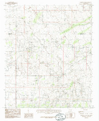
1985 Map of Henshaw Tank
USGS Topo · Published 1985About this map
The boundary between Chaves Co and Eddy Co cuts across this high desert landscape, which in the late 1970s was defined by a sophisticated water management and industrial network. An extensive Underground Aqueduct snakes through the terrain, supported by facilities like a Pumping Sta and Pump Sta, illustrating the region's reliance on piped water for ranching and industry. Isolated water sources such as Henshaw Tank and Bogle Tank serve as vital landmarks in an area otherwise marked by dispersed Gravel Pits. The map reveals the infrastructure of a working landscape where resource extraction and water transport are the primary drivers of human activity.
Find a feature on this map
8 named features on this map. Tap any name to fly to it.
Don’t see what you’re looking for? This feature index may not catch every label — zoom into the map to look around manually.
Map Details
Editions of this 1985 Henshaw Tank Map
This is the sole edition of this map. No revisions or reprints were ever made.
Other maps of this area

1951 · King Camp
USGS Topo · 1:24,000

1953 · Basin Well
USGS Topo · 1:24,000

1954 · Carlsbad
USGS Topo · 1:250,000

1954 · Hobbs
USGS Topo · 1:250,000

1954 · Brownfield
USGS Topo · 1:250,000

1955 · Red Lake SE
USGS Topo · 1:24,000

1955 · Roswell
USGS Topo · 1:250,000

1958 · Carlsbad
USGS Topo · 1:250,000

1958 · Brownfield
USGS Topo · 1:250,000

1958 · Roswell
USGS Topo · 1:250,000