1985 Map of Hereford
USGS Topo · Published 1985About this map
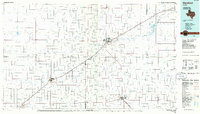
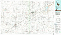
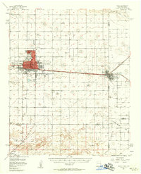
Hereford serves as the central hub for this High Plains landscape, where the agricultural grid is defined by a network of ephemeral watercourses and vital rail lines. The Atchison Topeka and Santa Fe railroad cuts diagonally across the territory, connecting Hereford with smaller agricultural settlements like Summerfield and Bovina. To the northeast, the Buffalo Lake National Wildlife Refuge provides a distinct break from the surrounding farmland, marking the importance of the Buffalo Lake basin in this semi-arid region. The map documents a landscape of large-scale ranching and farming operations, evidenced by the numerous small settlements such as Nazareth, Dimmitt, and Friona. Drainage patterns are traced through dry draws including Frio Draw, Middle Tule Draw, and Running Water Draw, which reveal the underlying topography of the Llano Estacado. Private aviation interests are also noted, with locations like Berger Air Park and the Municipal Airport supporting the region's wide-ranging connectivity.
Find a feature on this map
43 named features on this map. Tap any name to fly to it.
Don’t see what you’re looking for? This feature index may not catch every label — zoom into the map to look around manually.
Map Details
Editions of this 1985 Hereford Map
2 editions found
Other maps of this area

1954 · Tucumcari
USGS Topo · 1:250,000

1954 · Amarillo
USGS Topo · 1:250,000

1954 · Plainview
USGS Topo · 1:250,000

1954 · Clovis
USGS Topo · 1:250,000
1957 · Clovis
USGS Topo · 1:62,500

1957 · Pleasant Hill
USGS Topo · 1:62,500

1958 · Clovis
USGS Topo · 1:250,000

1958 · Amarillo
USGS Topo · 1:250,000

1958 · Tucumcari
USGS Topo · 1:250,000

1958 · Plainview
USGS Topo · 1:250,000