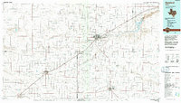
1985 Map of Hereford
USGS Topo · Published 1992About this map
The High Plains of the Texas Panhandle are defined here by a network of ephemeral draws and sprawling cattle-country settlements during the mid-1980s. Hereford, the seat of Deaf Smith County, serves as the regional hub where rail lines intersect with the path of Tierra Blanca Creek. To the east, the Buffalo Lake National Wildlife Refuge and its namesake Buffalo Lake create a distinct ecological pocket within the agricultural grid. The landscape is characterized by a series of geographic depressions and drainage features, including Frio Draw, Black Water Draw, and Running Water Draw, which have historically dictated the placement of small communities like Summerfield and Easter. From the grain elevators of Dimmitt to the aviation landmarks of Benger Air Park and the Municipal Airport, this survey documents the infrastructure of the Llano Estacado's rural economy.
Find a feature on this map
39 named features on this map. Tap any name to fly to it.
Don’t see what you’re looking for? This feature index may not catch every label — zoom into the map to look around manually.
Map Details
Editions of this 1985 Hereford Map
2 editions found
Other maps of this area

1954 · Tucumcari
USGS Topo · 1:250,000

1954 · Amarillo
USGS Topo · 1:250,000

1954 · Plainview
USGS Topo · 1:250,000

1954 · Clovis
USGS Topo · 1:250,000

1957 · Clovis
USGS Topo · 1:62,500

1957 · Pleasant Hill
USGS Topo · 1:62,500

1958 · Clovis
USGS Topo · 1:250,000

1958 · Amarillo
USGS Topo · 1:250,000

1958 · Tucumcari
USGS Topo · 1:250,000

1958 · Plainview
USGS Topo · 1:250,000