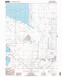
1988 Map of Herlong
USGS Topo · Published 1989About this map
The Sierra Army Depot dominates the eastern landscape of the Honey Lake Valley, revealing a complex network of military infrastructure in the late 1980s. This survey details the transition from the arid expanse of Honey Lake and the sand dunes near Sheep Springs to the organized residential and industrial grids of Patton Village and Herlong. The map captures the significant military presence of the era, marked by a Pistol Skeet Range, a Rifle Range, and the Abandoned Ordnance Disposal Area. To the south, the Doyle State Wildlife Area sits alongside Long Valley Creek, while transportation history is preserved through the Old Railroad Grade and the Herlong Junction area, illustrating how government activity and natural basin topography shaped this part of Lassen County.
Find a feature on this map
27 named features on this map. Tap any name to fly to it.
Don’t see what you’re looking for? This feature index may not catch every label — zoom into the map to look around manually.
Map Details
Editions of this 1988 Herlong Map
2 editions found
Other maps of this area

1886 · Honey Lake
USGS Topo · 1:250,000

1891 · Honey Lake
USGS Topo · 1:250,000

1893 · Honey Lake
USGS Topo · 1:250,000

1950 · Milford
USGS Topo · 1:62,500

1954 · Wendel
USGS Topo · 1:62,500

1954 · Litchfield
USGS Topo · 1:62,500

1954 · Doyle
USGS Topo · 1:62,500

1955 · Westwood
USGS Topo · 1:250,000

1958 · Westwood
USGS Topo · 1:250,000

1959 · Westwood
USGS Topo · 1:250,000