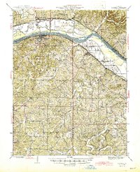
1945 Map of Hermann
USGS Topo · Published 1945About this map
Hermann serves as the focal point of this mid-1940s landscape, situated where the Missouri Pacific railroad traces the south bank of the Missouri River. The area shows a high density of rural social infrastructure, with family and parish landmarks like St Johns Cem and St Josephs Ch serving the surrounding agricultural communities. To the north across the river, the village of McKittrick lies near the mouth of the Loutre River, while to the east, settlements like Berger and Bernheimer are linked by the rail line.
Find a feature on this map
70 named features on this map. Tap any name to fly to it.
Don’t see what you’re looking for? This feature index may not catch every label — zoom into the map to look around manually.
Map Details
Editions of this 1945 Hermann Map
2 editions found

Other maps of this area

1890 · Hermann
USGS Topo · 1:125,000

1890 · Fulton
USGS Topo · 1:125,000

1903 · Sullivan
USGS Topo · 1:125,000

1934 · Bland
USGS Topo · 1:62,500

1935 · Gerald
USGS Topo · 1:48,000

1935 · Morrison
USGS Topo · 1:48,000

1936 · Hermann
USGS Topo · 1:48,000

1937 · Bland
USGS Topo · 1:62,500

1940 · Montgomery City
USGS Topo · 1:62,500

1941 · Gerald
USGS Topo · 1:62,500