
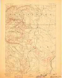
1894 Map of Hermosa
USGS Topo · Published 1894About this map
Gold mining operations and early Black Hills settlements define this 1894 survey of the borderlands between Pennington and Custer counties. The landscape is marked by the industrial footprint of the Etta Mine and the clustering of mountain communities like Keystone, Sheridan, and Rockerville. These high-country settlements, often tied to the mineral wealth of the gulches, contrast with the valley outposts of Hermosa and Fairburn situated along the Missouri River and Northwestern Railroad.
Find a feature on this map
28 named features on this map. Tap any name to fly to it.
Don’t see what you’re looking for? This feature index may not catch every label — zoom into the map to look around manually.
Map Details
Editions of this 1894 Hermosa Map
2 editions found
Other maps of this area

1893 · Rapid
USGS Topo · 1:125,000

1894 · Deadwood
USGS Topo · 1:125,000

1896 · Oelrichs
USGS Topo · 1:125,000

1896 · Harney Peak
USGS Topo · 1:125,000

1898 · Rapid
USGS Topo · 1:125,000

1900 · Oelrichs
USGS Topo · 1:125,000

1901 · Hermosa
USGS Topo · 1:125,000

1901 · Harney Peak
USGS Topo · 1:125,000

1901 · Deadwood
USGS Topo · 1:125,000

1902 · Edgemont
USGS Topo · 1:125,000