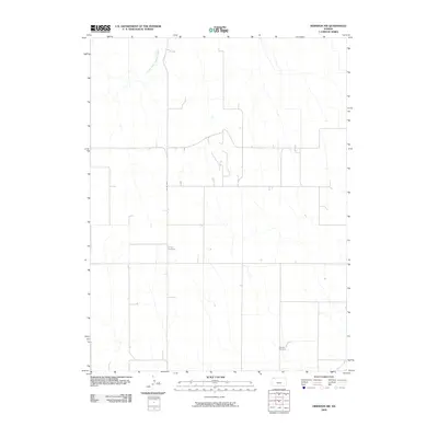
2009 Map of Herndon NW
USGS Topo · Published 2009About this map
The high plains of Rawlins County are defined by a grid of section lines and the meandering paths of intermittent waterways like South Fork Driftwood Creek in the north and Beaver Creek in the southeast. This landscape remains primarily agricultural, with infrastructure limited to local routes such as Co Rd 439 that connect isolated homesteads. For genealogists and local historians, the map provides precise locations for two notable burial grounds: Trinity Cemetery, situated in the central portion of the quadrangle, and Hamper Cemetery, located further south. These landmarks, often established by early settler families, serve as the primary fixed points in an otherwise open, rural expanse of northwest Kansas.
Find a feature on this map
5 named features on this map. Tap any name to fly to it.
Don’t see what you’re looking for? This feature index may not catch every label — zoom into the map to look around manually.
Map Details
Editions of this 2009 Herndon NW Map
This is the sole edition of this map. No revisions or reprints were ever made.
Other maps of this area

1951 · Herndon
USGS Topo · 1:62,500

1951 · Atwood
USGS Topo · 1:62,500

1954 · McCook
USGS Topo · 1:250,000

1954 · Goodland
USGS Topo · 1:250,000

1956 · Goodland
USGS Topo · 1:250,000

1957 · McCook
USGS Topo · 1:250,000

1957 · Goodland
USGS Topo · 1:250,000

1958 · McCook
USGS Topo · 1:250,000

1962 · Culbertson SW
USGS Topo · 1:24,000
1962 · Trenton SE
USGS Topo · 1:24,000