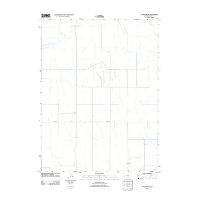
2012 Map of Herndon NW
USGS Topo · Published 2012About this map
S Fork Driftwood Cr meanders across the northwestern corner of this High Plains landscape, characterizing the drainage patterns of northern Rawlins County. This modern survey illustrates a sparsely populated agricultural region defined by a precise section-line road network, including arterial routes like Co Rd-314 and Co Rd-439. Family and local history is anchored by small rural burial grounds such as Trinity Cem in the central portion of the sheet and Hamper Cem near the southeastern corner. In the south, the terrain descends toward the valley of Beaver Cr, where the interplay of intermittent stream beds and cultivated fields reveals the local reliance on the limited water resources of this Kansas prairie.
Find a feature on this map
6 named features on this map. Tap any name to fly to it.
Don’t see what you’re looking for? This feature index may not catch every label — zoom into the map to look around manually.
Map Details
Editions of this 2012 Herndon NW Map
This is the sole edition of this map. No revisions or reprints were ever made.
Other maps of this area

1951 · Herndon
USGS Topo · 1:62,500

1951 · Atwood
USGS Topo · 1:62,500

1954 · McCook
USGS Topo · 1:250,000

1954 · Goodland
USGS Topo · 1:250,000

1956 · Goodland
USGS Topo · 1:250,000

1957 · McCook
USGS Topo · 1:250,000

1957 · Goodland
USGS Topo · 1:250,000

1958 · McCook
USGS Topo · 1:250,000

1962 · Culbertson SW
USGS Topo · 1:24,000
1962 · Trenton SE
USGS Topo · 1:24,000