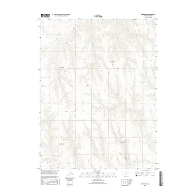
2015 Map of Herndon NW
USGS Topo · Published 2015About this map
S Fork Driftwood Cr and Beaver Cr define the drainage patterns of this rural landscape in Rawlins County. The map provides a detailed view of the section lines and rural road network that structures the agricultural land, featuring thoroughfares like Co Rd 314 and Co Rd 419. Two key sites for genealogical research are clearly marked: Trinity Cem in the central-western portion of the quadrangle and Hamper Cem further south. These cemeteries serve as vital anchors for local family history in a region dominated by wide-open terrain and the established Public Land Survey System boundaries of t1s r33w and t1s r32w. The 2015 survey illustrates how the high plains of northwest Kansas remain organized by a strict grid of gravel roads, such as Rd Bb and Rd Aa, reflecting over a century of land management.
Find a feature on this map
22 named features on this map. Tap any name to fly to it.
Don’t see what you’re looking for? This feature index may not catch every label — zoom into the map to look around manually.
Map Details
Editions of this 2015 Herndon NW Map
This is the sole edition of this map. No revisions or reprints were ever made.
Other maps of this area

1951 · Herndon
USGS Topo · 1:62,500

1951 · Atwood
USGS Topo · 1:62,500

1954 · McCook
USGS Topo · 1:250,000

1954 · Goodland
USGS Topo · 1:250,000

1956 · Goodland
USGS Topo · 1:250,000

1957 · McCook
USGS Topo · 1:250,000

1957 · Goodland
USGS Topo · 1:250,000

1958 · McCook
USGS Topo · 1:250,000

1962 · Culbertson SW
USGS Topo · 1:24,000
1962 · Trenton SE
USGS Topo · 1:24,000