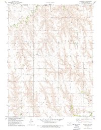
1978 Map of Herndon NW
USGS Topo · Published 1979About this map
Elk, Ludell, and Herndon townships meet in this corner of Northwest Kansas, where the state border aligns with the Nebraska Kansas line. The landscape is defined by the drainage of the South Fork Driftwood Creek and Beaver Cr, supporting a rural economy of agriculture and energy extraction. A developed Oil Field with numerous Oil Wells is connected by a branching Pipeline network across the upland draws. Traces of early community life are centered around the Trinity Ch and the settlement at Timm. Family history and genealogy researchers may find interest in the isolated burial markers noted as Grave and Graves, along with several small-scale industrial sites like the Sandpit near the southern boundary.
Find a feature on this map
15 named features on this map. Tap any name to fly to it.
Don’t see what you’re looking for? This feature index may not catch every label — zoom into the map to look around manually.
Map Details
Editions of this 1978 Herndon NW Map
This is the sole edition of this map. No revisions or reprints were ever made.
Other maps of this area

1951 · Herndon
USGS Topo · 1:62,500

1951 · Atwood
USGS Topo · 1:62,500

1954 · McCook
USGS Topo · 1:250,000

1954 · Goodland
USGS Topo · 1:250,000

1956 · Goodland
USGS Topo · 1:250,000

1957 · McCook
USGS Topo · 1:250,000

1957 · Goodland
USGS Topo · 1:250,000

1958 · McCook
USGS Topo · 1:250,000

1962 · Culbertson SW
USGS Topo · 1:24,000
1962 · Trenton SE
USGS Topo · 1:24,000