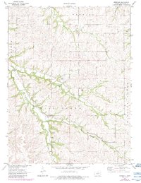
1971 Map of Hessdale
USGS Topo · Published 1984About this map
Hessdale sits at the intersection of water and historic transit in this portion of Wabaunsee County. The landscape is defined by the winding course of Mill Creek and its many tributaries, including Nehring Creek and the East Branch Mill Creek. A significant historical marker, the Old Indian Treaty Boundary, cuts across the northern townships of Newbury and Farmer, reflecting the structured land divisions of the nineteenth century.
Find a feature on this map
20 named features on this map. Tap any name to fly to it.
Don’t see what you’re looking for? This feature index may not catch every label — zoom into the map to look around manually.
Map Details
Editions of this 1971 Hessdale Map
2 editions found
Other maps of this area

1885 · Eskridge
USGS Topo · 1:125,000

1889 · Wamego
USGS Topo · 1:125,000

1889 · Eskridge
USGS Topo · 1:125,000

1894 · Eskridge
USGS Topo · 1:125,000

1894 · Wamego
USGS Topo · 1:125,000

1953 · Maple Hill
USGS Topo · 1:24,000

1954 · Alma
USGS Topo · 1:24,000

1954 · Mc Farland
USGS Topo · 1:24,000

1955 · Manhattan
USGS Topo · 1:250,000

1955 · Hutchinson
USGS Topo · 1:250,000