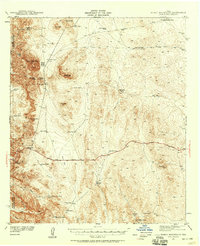
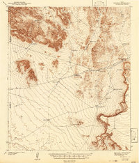
1941 Map of Heuco Mountains
USGS Topo · Published 1958About this map
The Hueco Mountains straddle the boundary between El Paso and Hudspeth County, forming a landscape where survival depended on the strategic placement of dozens of catchment systems. This 1941 survey records the reliance on isolated water sources like Hackberry Tank, Nine-mile Tank, and Walbridge Tanks, essential for ranching operations such as Helms Ranch and the travelers stopping at the Hueco Inn. The terrain is marked by prominent peaks including Cerro Alto Mtn and Deer Mtn, which provided landmarks for early travelers along the historic Butterfield Trail.
Find a feature on this map
45 named features on this map. Tap any name to fly to it.
Don’t see what you’re looking for? This feature index may not catch every label — zoom into the map to look around manually.
Map Details
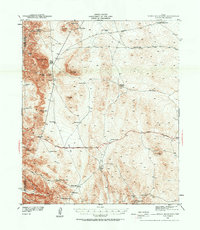
Editions of this 1941 Heuco Mountains Map
2 editions found
Other maps of this area

1896 · El Paso
USGS Topo · 1:125,000

1903 · Cerro Alto
USGS Topo · 1:125,000

1908 · El Paso
USGS Topo · 1:125,000

1939 · Heuco Tanks
USGS Topo · 1:62,500

1940 · Heuco Tanks
USGS Topo · 1:62,500

1940 · Bassett Lake
USGS Topo · 1:62,500
1941 · Clint
USGS Topo · 1:62,500
1941 · Desert
USGS Topo · 1:62,500
1942 · Borrego
USGS Topo · 1:62,500
1943 · Tepee Butte
USGS Topo · 1:62,500