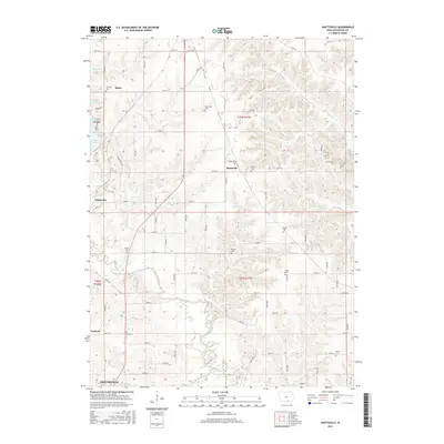
2015 Map of Hiattsville
USGS Topo · Published 2015About this map
Centerville and the rural communities of Appanoose County occupy this landscape of meandering watercourses and upland ridges. The Chariton River winds through the southern half of the quadrangle, joined by tributaries such as Snort Cr and Cooper Cr. This area is characterized by a high density of small rural burial grounds, including Fairview Cem, New Hope Cem, and Denny Cem, which are often located near the small settlements of Hiattsville, Maine, and Darbyville.
Find a feature on this map
71 named features on this map. Tap any name to fly to it.
Don’t see what you’re looking for? This feature index may not catch every label — zoom into the map to look around manually.
Map Details
Editions of this 2015 Hiattsville Map
This is the sole edition of this map. No revisions or reprints were ever made.
Other maps of this area

1939 · Centerville
USGS Topo · 1:62,500

1939 · Mystic
USGS Topo · 1:62,500

1941 · Centerville
USGS Topo · 1:62,500

1942 · Mystic
USGS Topo · 1:62,500

1954 · Centerville
USGS Topo · 1:250,000

1957 · Centerville
USGS Topo · 1:250,000

1958 · Centerville
USGS Topo · 1:250,000

1966 · Hiattsville
USGS Topo · 1:24,000
1966 · Mystic
USGS Topo · 1:24,000

1968 · Unionville
USGS Topo · 1:24,000