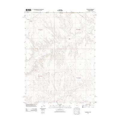
2013 Map of Hiawatha
USGS Topo · Published 2013About this map
Hiawatha sits at the high, windswept border of northwest Colorado and Wyoming, a landscape defined by drainage patterns and distinct topographic shifts. The terrain is deeply incised by Hells Canyon, while Shell Creek and Dry Creek trace the principal watercourses through this high-altitude environment. This 2013 survey illustrates the remote character of the Moffat County borderlands, where the primary infrastructure consists of isolated routes like CO Road 4. The map provides a detailed view of the township and range system, including t012n r100w and t011n r100w, showing how the land is partitioned across the high plains and canyons of this frontier region.
Find a feature on this map
11 named features on this map. Tap any name to fly to it.
Don’t see what you’re looking for? This feature index may not catch every label — zoom into the map to look around manually.
Map Details
Editions of this 2013 Hiawatha Map
This is the sole edition of this map. No revisions or reprints were ever made.
Other maps of this area

1954 · Vernal
USGS Topo · 1:250,000

1954 · Rock Springs
USGS Topo · 1:250,000

1958 · Vernal
USGS Topo · 1:250,000

1958 · Rock Springs
USGS Topo · 1:250,000

1960 · Vernal
USGS Topo · 1:250,000

1962 · Rock Springs
USGS Topo · 1:250,000

1966 · G Spring
USGS Topo · 1:24,000

1966 · Sugarloaf Butte
USGS Topo · 1:24,000

1966 · Irish Canyon
USGS Topo · 1:24,000

1966 · Hiawatha
USGS Topo · 1:24,000