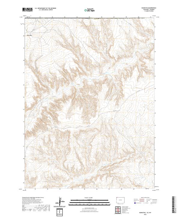
2022 Map of Hiawatha
USGS Topo · Published 2022About this map
Hiawatha sits in the northwestern corner of this territory along the border of Colorado and Wyoming, serving as the primary point of settlement in an otherwise sparse landscape. The area is defined by significant drainage systems, including the winding course of Shell Cr which cuts through the central sections of the quadrangle, and Dry Cr further south. The terrain is marked by the distinct formation of Hells Canyon, showing a complex topography of ridges and valleys in the northeastern portion of the sheet. Modern transport is dictated by a network of county roads, specifically Co RD 4, Co RD 4s, and Co RD 4w, which provide the only developed access across this high-desert environment. This survey captures a moment of remote rural life where the landscape remains largely open, shaped primarily by natural drainages and the long-established township and range grid.
Find a feature on this map
12 named features on this map. Tap any name to fly to it.
Don’t see what you’re looking for? This feature index may not catch every label — zoom into the map to look around manually.
Map Details
Editions of this 2022 Hiawatha Map
This is the sole edition of this map. No revisions or reprints were ever made.
Other maps of this area

1954 · Vernal
USGS Topo · 1:250,000

1954 · Rock Springs
USGS Topo · 1:250,000

1958 · Vernal
USGS Topo · 1:250,000

1958 · Rock Springs
USGS Topo · 1:250,000

1960 · Vernal
USGS Topo · 1:250,000

1962 · Rock Springs
USGS Topo · 1:250,000

1966 · G Spring
USGS Topo · 1:24,000

1966 · Sugarloaf Butte
USGS Topo · 1:24,000

1966 · Irish Canyon
USGS Topo · 1:24,000

1966 · Hiawatha
USGS Topo · 1:24,000