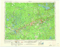
1954 Map of Hibbing
USGS Topo · Published 1974About this map
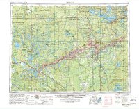
The Mesabi Range and Vermilion Range anchor this mid-century survey, revealing the industrial skeleton of Northern Minnesota’s Iron Range. The map details a landscape defined by extraction and transport, where numerous mines are clustered around settlements like Hibbing, Virginia, Chisholm, and Eveleth. This dense industrial corridor is serviced by an intricate network of railroads including the Great Northern Railway and the Duluth, Missabe and Iron Range Railway, which were essential for moving ore to the Great Lakes ports.
Find a feature on this map
352 named features on this map. Tap any name to fly to it.
Don’t see what you’re looking for? This feature index may not catch every label — zoom into the map to look around manually.
Map Details
Editions of this 1954 Hibbing Map
3 editions found

Other maps of this area

1895 · Duluth
USGS Topo · 1:62,500

1918 · Zora
USGS Topo · 1:62,500

1919 · Zora
USGS Topo · 1:62,500

1919 · Lundgren
USGS Topo · 1:62,500

1919 · Gemmell
USGS Topo · 1:62,500

1919 · Max
USGS Topo · 1:62,500

1919 · Release
USGS Topo · 1:62,500

1919 · Marcell
USGS Topo · 1:62,500

1919 · M
USGS Topo · 1:62,500

1919 · Margie
USGS Topo · 1:62,500