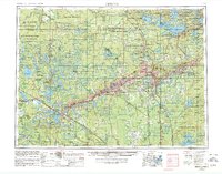
1954 Map of Hibbing
USGS Topo · Published 1980About this map
The Mesabi Range dominates the eastern landscape of this mid-century survey, where the heavy industry of the Duluth Missabe and Iron Range railroad and the Duluth Winnipeg and Pacific line serve the mining hubs of Hibbing, Virginia, Chisholm, and Eveleth. To the west, the character of the land shifts toward the sprawling wetlands and waters of the Leech Lake Indian Res and Bowstring Lake. This era shows the massive footprint of state and national forestry management, with vast tracts including the Koochiching State Forest and George Washington State Forest blanketing the northern counties. Local navigation relies on a network of routes such as U.S. 2 and Minn. 169, connecting smaller timber and lakeside settlements like Grand Rapids, Effie, and Bigfork to the industrial heart of the Iron Range. The map also captures the early preservation of the Boundary Waters Canoe Area and the recreational development of Tower Soudan State Park.
Find a feature on this map
273 named features on this map. Tap any name to fly to it.
Don’t see what you’re looking for? This feature index may not catch every label — zoom into the map to look around manually.
Map Details
Editions of this 1954 Hibbing Map
3 editions found

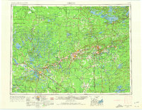
Other maps of this area

1895 · Duluth
USGS Topo · 1:62,500

1918 · Zora
USGS Topo · 1:62,500

1919 · Zora
USGS Topo · 1:62,500

1919 · Lundgren
USGS Topo · 1:62,500

1919 · Gemmell
USGS Topo · 1:62,500

1919 · Max
USGS Topo · 1:62,500

1919 · Release
USGS Topo · 1:62,500

1919 · Marcell
USGS Topo · 1:62,500

1919 · M
USGS Topo · 1:62,500

1919 · Margie
USGS Topo · 1:62,500