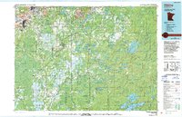
1977 Map of Hibbing
USGS Topo · Published 1994About this map
The industrial heart of the Mesabi Range is laid bare in this late-1970s survey, dominated by massive open-pit operations like the Hull-Rust-Mahoning Mine and the Minntac Mine. This landscape in northern St. Louis County is a study in the intersection of extraction and wilderness, where the Duluth Missabe and Iron Range Ry and Burlington Northern lines weave through the Superior National Forest to connect iron hubs like Hibbing, Chisholm, and Virginia.
Find a feature on this map
121 named features on this map. Tap any name to fly to it.
Don’t see what you’re looking for? This feature index may not catch every label — zoom into the map to look around manually.
Map Details
Editions of this 1977 Hibbing Map
This is the sole edition of this map. No revisions or reprints were ever made.
Other maps of this area

1895 · Duluth
USGS Topo · 1:62,500

1949 · Aurora
USGS Topo · 1:24,000

1949 · Allen
USGS Topo · 1:24,000

1950 · Allen
USGS Topo · 1:24,000

1950 · Aurora
USGS Topo · 1:24,000

1950 · Biwabik
USGS Topo · 1:24,000

1950 · Mc Kinley
USGS Topo · 1:24,000

1951 · Biwabik
USGS Topo · 1:24,000

1951 · Mc Kinley
USGS Topo · 1:24,000

1951 · Palo
USGS Topo · 1:24,000