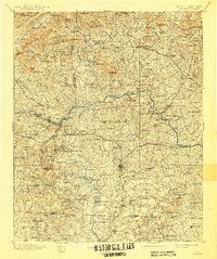
1895 Map of Hickory
USGS Topo · Published 1941About this map
The Catawba River winds through the heart of this landscape, a critical artery for the Piedmont's early industry and transport. During the late nineteenth century, this region relied on a network of ferries and fords like Oxford Ford and Arnt Ferry to bridge communities before the widespread construction of permanent bridges. The map reveals a robust mill-based economy, with family and commercial operations such as Cloninger's Mill, Etowah Mill, and even a Cotton Factory near Maiden powering local growth.
Find a feature on this map
179 named features on this map. Tap any name to fly to it.
Don’t see what you’re looking for? This feature index may not catch every label — zoom into the map to look around manually.
Map Details
Editions of this 1895 Hickory Map
5 editions found
Other maps of this area

1889 · Wilkesboro
USGS Topo · 1:125,000

1891 · Wilkesboro
USGS Topo · 1:125,000

1891 · Yadkinville
USGS Topo · 1:125,000

1893 · Cranberry
USGS Topo · 1:125,000

1893 · Statesville
USGS Topo · 1:125,000

1893 · Yadkinville
USGS Topo · 1:125,000

1895 · Hickory
USGS Topo · 1:125,000

1895 · Cranberry
USGS Topo · 1:125,000

1899 · Cranberry
USGS Topo · 1:125,000

1902 · Cranberry
USGS Topo · 1:125,000