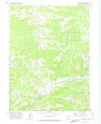
1972 Map of Hidden Lake
USGS Topo · Published 1974About this map
The Weber River cuts through this high-altitude landscape in the Wasatch National Forest, serving as a primary corridor for travel and drainage. During the early 1970s, this area of Summit County was characterized by a network of trails and essential water management features, including the Elkhorn Reservoir and the namesake Hidden Lake. The terrain is defined by dramatic changes in elevation, from the Mahogany Hills to the deep cut of Frazier Hollow. Resource extraction is evidenced by the Gravel Pits located near the riverbank, while the confluence of Smith and Morehouse Creek and the South Fork Weber River highlights the complex hydrology of the region. This survey captures a moment when the land was primarily managed for timber, grazing, and watershed protection, with features like a Corral and various jeep trails indicating the rugged utility of the back-country.
Find a feature on this map
30 named features on this map. Tap any name to fly to it.
Don’t see what you’re looking for? This feature index may not catch every label — zoom into the map to look around manually.
Map Details
Editions of this 1972 Hidden Lake Map
3 editions found
Other maps of this area

1885 · Salt Lake
USGS Topo · 1:250,000

1900 · Coalville
USGS Topo · 1:125,000

1903 · Coalville
USGS Topo · 1:125,000

1954 · Salt Lake City
USGS Topo · 1:250,000

1958 · Salt Lake City
USGS Topo · 1:250,000

1960 · Salt Lake City
USGS Topo · 1:250,000
1967 · Turner Hollow
USGS Topo · 1:24,000

1967 · Kamas
USGS Topo · 1:24,000
1967 · Upton
USGS Topo · 1:24,000
1967 · Crandall Canyon
USGS Topo · 1:24,000