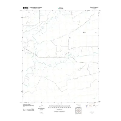
2009 Map of Higgins
USGS Topo · Published 2009About this map
Gaines Creek and its many meandering tributaries define the hydrology of this Latimer County landscape in the early twenty-first century. The map illustrates a rural environment where water management and traditional landmarks remain central to the local geography. Significant water bodies include Cedar Creek and Buffalo Creek, while the Oknoname 06003 Dam indicates modern infrastructure near the base of Blue Mountain. For those researching local history, the Mountain Station Cemetery serves as a vital anchor point along Mountain Station Rd, reflecting the area's long-standing community ties. The road network, including Higgins Damon Valley Rd and Gowen Cemetery Rd, provides a framework for understanding the connectivity of these remote Oklahoma hillsides before further development.
Find a feature on this map
16 named features on this map. Tap any name to fly to it.
Don’t see what you’re looking for? This feature index may not catch every label — zoom into the map to look around manually.
Map Details
Editions of this 2009 Higgins Map
This is the sole edition of this map. No revisions or reprints were ever made.
Other maps of this area

1898 · McAlester
USGS Topo · 1:125,000

1901 · Tuskahoma
USGS Topo · 1:125,000

1908 · Tuskahoma
USGS Topo · 1:125,000

1909 · Mc Alester
USGS Topo · 1:125,000

1909 · Tuskahoma
USGS Topo · 1:125,000

1950 · Mcalester
USGS Topo · 1:250,000

1962 · McAlester
USGS Topo · 1:250,000

1965 · McAlester
USGS Topo · 1:250,000
1967 · Adamson
USGS Topo · 1:24,000

1967 · Hartshorne
USGS Topo · 1:24,000