
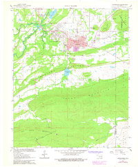
1967 Map of Hartshorne
USGS Topo · Published 1968About this map
Hartshorne and its neighboring town Haileyville sit at the northern edge of a complex geological uplift, where Limestone Ridge and Blue Mountain dominate the southern half of the quadrangle. The industrial character of this late-1960s landscape is defined by the Chicago Rock Island and Pacific Railroad and an Old Railroad Grade that speaks to the region's history of coal and transport. Local community life is documented through several burial grounds, including Elmwood Cemetery, Elm Park Cem, and Holy Rosary Cem. Beyond the residential centers, the map reveals smaller settlements like Dow and Craig, while the massive profiles of Belle Starr Mountain and New State Mountain loom over the headwaters of Buffalo Creek. The presence of Lone Oak Sch and several municipal landmarks in the town centers provides a detailed look at the rural Oklahoma infrastructure of the era.
Find a feature on this map
37 named features on this map. Tap any name to fly to it.
Don’t see what you’re looking for? This feature index may not catch every label — zoom into the map to look around manually.
Map Details
Editions of this 1967 Hartshorne Map
2 editions found
Other maps of this area

1898 · McAlester
USGS Topo · 1:125,000

1901 · Tuskahoma
USGS Topo · 1:125,000

1908 · Tuskahoma
USGS Topo · 1:125,000

1909 · Mc Alester
USGS Topo · 1:125,000

1909 · Tuskahoma
USGS Topo · 1:125,000

1950 · Mcalester
USGS Topo · 1:250,000

1962 · McAlester
USGS Topo · 1:250,000

1965 · McAlester
USGS Topo · 1:250,000

1967 · Krebs
USGS Topo · 1:24,000
1967 · Adamson
USGS Topo · 1:24,000