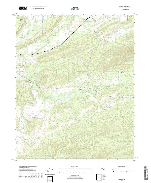
2022 Map of Higgins
USGS Topo · Published 2022About this map
Higgins sits at the center of this rural Oklahoma landscape, where the terrain is defined by the significant ridges of Number Ten Mtn and Blue Mtn. The area is carved by a complex network of waterways, most notably Gaines Creek and Buffalo Creek, which dictate the local topography and road placement. This 2022 survey preserves the contemporary alignment of rural routes such as Higgins Damon Valley Rd and Mountain Station Rd, illustrating how modern infrastructure follows the natural corridors between the peaks. Local history and genealogy are anchored by landmarks like the Mountain Station Cem, while the section lines and township boundaries—including t4n r18e and t5n r17e—provide the essential cadastral framework for tracing property and family land ties in Latimer County.
Find a feature on this map
33 named features on this map. Tap any name to fly to it.
Don’t see what you’re looking for? This feature index may not catch every label — zoom into the map to look around manually.
Map Details
Editions of this 2022 Higgins Map
This is the sole edition of this map. No revisions or reprints were ever made.
Other maps of this area

1898 · McAlester
USGS Topo · 1:125,000

1901 · Tuskahoma
USGS Topo · 1:125,000

1908 · Tuskahoma
USGS Topo · 1:125,000

1909 · Mc Alester
USGS Topo · 1:125,000

1909 · Tuskahoma
USGS Topo · 1:125,000

1950 · Mcalester
USGS Topo · 1:250,000

1962 · McAlester
USGS Topo · 1:250,000

1965 · McAlester
USGS Topo · 1:250,000
1967 · Adamson
USGS Topo · 1:24,000

1967 · Hartshorne
USGS Topo · 1:24,000