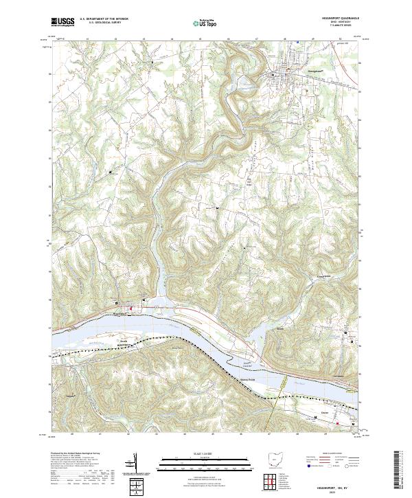
2023 Map of Higginsport
USGS Topo · Published 2023About this map
The Ohio River carves a deep valley along the border of Ohio and Kentucky, anchoring a landscape where river commerce and upland farming meet. The settlement of Higginsport occupies the northern bank, directly across from South Higginsport, while downstream the town of Augusta and the landing at Levanna mark the historic importance of the waterway. Inland, the terrain rises into prominent features like Cahall Ridge and Lyon Ridge, dissected by numerous drainages such as White Oak Creek and Straight Creek. The county seat of Georgetown sits at the northern edge of the map, centered on the Brown County Courthouse. For genealogists, the map is densely populated with rural burial grounds including Eden Cem, Sallee Cem, and the Hill Family Cem. This modern survey provides a clear view of how ancestral family lands and ridges continue to define the local geography today.
Find a feature on this map
132 named features on this map. Tap any name to fly to it.
Don’t see what you’re looking for? This feature index may not catch every label — zoom into the map to look around manually.
Map Details
Editions of this 2023 Higginsport Map
This is the sole edition of this map. No revisions or reprints were ever made.
Other maps of this area

1915 · Maysville
USGS Topo · 1:62,500

1919 · Maysville
USGS Topo · 1:62,500

1928 · Higginsport
USGS Topo · 1:48,000

1931 · Felicity
USGS Topo · 1:62,500

1931 · Higginsport
USGS Topo · 1:62,500

1952 · Germantown
USGS Topo · 1:24,000

1952 · Higginsport
USGS Topo · 1:24,000

1952 · Maysville West
USGS Topo · 1:24,000

1952 · Brooksville
USGS Topo · 1:24,000

1953 · Bethel
USGS Topo · 1:24,000