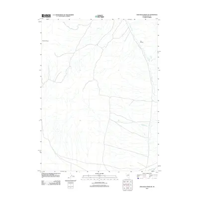
2012 Map of High Bald Peaks NE
USGS Topo · Published 2012About this map
Medicine Range anchors the western edge of this High Bald Peaks NE study, overlooking a complex drainage network that defines the high desert topography of eastern Nevada. The landscape is primarily shaped by the flow of Butte Creek, which snakes through the northeast corner of the quadrangle. A distinct geological constriction known as The Narrows appears along the creek's path, suggesting a significant point of topographical interest in an otherwise expansive basin environment. This 2012 survey illustrates the sparse, undeveloped character of this region of Elko County, where the primary human presence is marked only by a thin network of 4WD trails and local roads that follow the natural contours of the mountain foothills and creek beds.
Find a feature on this map
3 named features on this map. Tap any name to fly to it.
Don’t see what you’re looking for? This feature index may not catch every label — zoom into the map to look around manually.
Map Details
Editions of this 2012 High Bald Peaks NE Map
This is the sole edition of this map. No revisions or reprints were ever made.
Other maps of this area

1955 · Elko
USGS Topo · 1:250,000

1958 · Elko
USGS Topo · 1:250,000

1962 · Elko
USGS Topo · 1:250,000

1965 · Elko
USGS Topo · 1:250,000
1984 · Paris Creek
USGS Topo · 1:24,000
1984 · Mt. Taylor
USGS Topo · 1:24,000
1984 · High Bald Peaks SE
USGS Topo · 1:24,000
1984 · Silo Canyon
USGS Topo · 1:24,000
1984 · High Bald Peaks
USGS Topo · 1:24,000
1984 · Medicine Spring
USGS Topo · 1:24,000