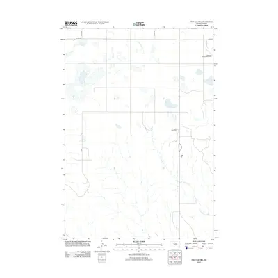
2012 Map of High Elk Hill
USGS Topo · Published 2012About this map
High Elk Hill rises as a prominent landmark amidst the high plains of South Dakota, where the landscape is defined by the ephemeral flow of creek beds and the grid of rural prairie roads. The land is marked by significant cultural and infrastructure points including the Saint Marks Cem, providing a quiet link to local family histories in this part of the Cheyenne River Reservation. Water drainage is dominated by the branching pathways of E Fork Rudy Cr, Green Grass Cr, and Herbert Cr, which carve subtle paths through the terrain. Transportation in this era relies on the intersection of Sound 63 and several county routes, while the Cheyenne Eagle Butte Airport serves as a modern aviation link for the surrounding communities. The presence of these small-scale features against the wide expanse of open country illustrates the sparse but intentional settlement patterns of the early 21st century.
Find a feature on this map
13 named features on this map. Tap any name to fly to it.
Don’t see what you’re looking for? This feature index may not catch every label — zoom into the map to look around manually.
Map Details
Editions of this 2012 High Elk Hill Map
This is the sole edition of this map. No revisions or reprints were ever made.
Other maps of this area

1953 · McIntosh
USGS Topo · 1:250,000

1954 · Pierre
USGS Topo · 1:250,000

1958 · Pierre
USGS Topo · 1:250,000

1958 · McIntosh
USGS Topo · 1:250,000
1981 · Herbert Creek
USGS Topo · 1:24,000
1981 · Parade SW
USGS Topo · 1:24,000
1981 · Herbert Creek SW
USGS Topo · 1:24,000
1981 · Lantry
USGS Topo · 1:24,000
1981 · High Elk Hill NW
USGS Topo · 1:24,000
1981 · High Elk Hill SE
USGS Topo · 1:24,000