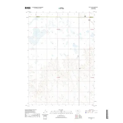
2017 Map of High Elk Hill
USGS Topo · Published 2017About this map
Eagle Butte occupies the northeastern corner of this 2017 survey, marking a significant point along the Dewey Co Ziebach Co line. The landscape transitions from the developed vicinity of the Cheyenne Eagle Butte Airport into the undulating terrain of the Cheyenne River Reservation. Central to this area is High Elk Hill, a prominent rise that overlooks a complex system of seasonal drainages, including E Fork Rudy Cr and Green Grass Cr. Local heritage is anchored at Saint Mark's Cem, which stands isolated amidst a network of county roads like Co RD 21e. This quadrangle illustrates the intersection of rural infrastructure and the vast natural grasslands, where the drainage of Herbert Cr flows southward through the open range.
Find a feature on this map
16 named features on this map. Tap any name to fly to it.
Don’t see what you’re looking for? This feature index may not catch every label — zoom into the map to look around manually.
Map Details
Editions of this 2017 High Elk Hill Map
This is the sole edition of this map. No revisions or reprints were ever made.
Other maps of this area

1953 · McIntosh
USGS Topo · 1:250,000

1954 · Pierre
USGS Topo · 1:250,000

1958 · Pierre
USGS Topo · 1:250,000

1958 · McIntosh
USGS Topo · 1:250,000

1981 · Herbert Creek
USGS Topo · 1:24,000

1981 · Parade SW
USGS Topo · 1:24,000

1981 · Herbert Creek SW
USGS Topo · 1:24,000

1981 · Lantry
USGS Topo · 1:24,000

1981 · High Elk Hill NW
USGS Topo · 1:24,000

1981 · High Elk Hill SE
USGS Topo · 1:24,000