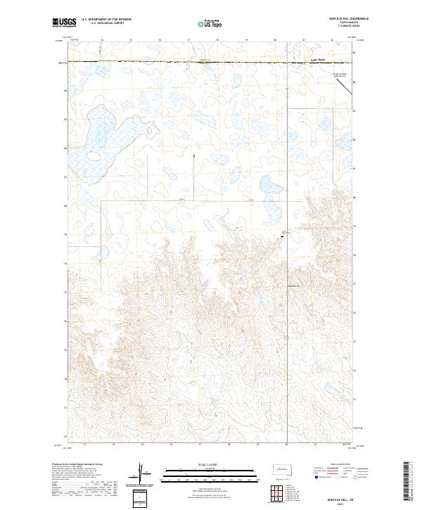
2021 Map of High Elk Hill
USGS Topo · Published 2021About this map
The high plains of Dewey and Ziebach counties meet along a section line in this modern topographic survey, dominated by the prominent elevation of High Elk Hill. The landscape transitions from the flatter northern reaches near Eagle Butte into a complex network of drainages and ridges to the south. Saint Marks Cem serves as a significant cultural landmark for local history, situated near the headwaters of Herbert Cr. The eastern portion of the map is defined by the Cheyenne Eagle Butte Airport, which marks the edge of the regional transportation infrastructure. A dense pattern of stream systems, including Green Grass Cr and the E Fork Rudy Cr, illustrates the hydrological character of this part of the Cheyenne River Reservation, where the terrain becomes increasingly dissected by erosion moving away from the primary plateaus.
Find a feature on this map
15 named features on this map. Tap any name to fly to it.
Don’t see what you’re looking for? This feature index may not catch every label — zoom into the map to look around manually.
Map Details
Editions of this 2021 High Elk Hill Map
This is the sole edition of this map. No revisions or reprints were ever made.
Other maps of this area

1953 · McIntosh
USGS Topo · 1:250,000

1954 · Pierre
USGS Topo · 1:250,000

1958 · Pierre
USGS Topo · 1:250,000

1958 · McIntosh
USGS Topo · 1:250,000

1981 · Herbert Creek
USGS Topo · 1:24,000

1981 · Parade SW
USGS Topo · 1:24,000

1981 · Herbert Creek SW
USGS Topo · 1:24,000

1981 · Lantry
USGS Topo · 1:24,000

1981 · High Elk Hill NW
USGS Topo · 1:24,000

1981 · High Elk Hill SE
USGS Topo · 1:24,000