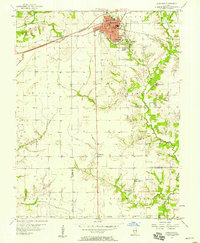
1957 Map of Highland
USGS Topo · Published 1958About this map
The city of Highland serves as the focal point of this mid-century survey, revealing the urban layout during a period of steady growth. The dense grid of the city is anchored by essential institutions like the High Sch and St Paul Sch, while Lindenthal Park provides a significant green space for the community. Beyond the city limits, the landscape transitions into agricultural plots and natural drainages such as Silver Creek and Buckeye Branch.
Find a feature on this map
32 named features on this map. Tap any name to fly to it.
Don’t see what you’re looking for? This feature index may not catch every label — zoom into the map to look around manually.
Map Details
Editions of this 1957 Highland Map
3 editions found
Other maps of this area

1906 · Breese
USGS Topo · 1:62,500

1907 · Breese
USGS Topo · 1:62,500

1907 · Belleville
USGS Topo · 1:62,500

1927 · Edwardsville
USGS Topo · 1:62,500

1932 · Edwardsville
USGS Topo · 1:62,500

1935 · Lebanon
USGS Topo · 1:24,000

1937 · New Douglas
USGS Topo · 1:48,000

1944 · New Douglas
USGS Topo · 1:62,500

1949 · Lebanon
USGS Topo · 1:24,000

1949 · St. Jacob
USGS Topo · 1:24,000