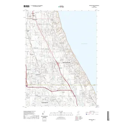
2021 Map of Highland Park
USGS Topo · Published 2021About this map
Lake Michigan forms the eastern boundary of this contemporary landscape, where a dense network of residential streets and established suburbs defines the North Shore region. The area is characterized by its organized municipal boundaries, stretching from Lake Forest and Highwood in the north down through Highland Park and into Northbrook. Inland, the Skokie River and the N Br Chicago River meander through several parklands and residential neighborhoods. Significant local history is preserved in various consecrated grounds, including the Fort Sheridan Post Cem near the lakefront and the Saint Marys Cem in Deerfield. The map reveals the intricate transition from high-density suburban blocks to the wooded environs of Bannockburn and Riverwoods, all connected by major thoroughfares like Dundee Rd and Deerfield Rd.
Find a feature on this map
44 named features on this map. Tap any name to fly to it.
Don’t see what you’re looking for? This feature index may not catch every label — zoom into the map to look around manually.
Map Details
Editions of this 2021 Highland Park Map
This is the sole edition of this map. No revisions or reprints were ever made.
Other maps of this area

1899 · Evanston
USGS Topo · 1:62,500

1900 · Highwood
USGS Topo · 1:62,500

1906 · Waukegan
USGS Topo · 1:62,500

1908 · Waukegan
USGS Topo · 1:62,500

1927 · Arlington Heights
USGS Topo · 1:24,000

1928 · Wheeling
USGS Topo · 1:24,000

1928 · Highland Park
USGS Topo · 1:24,000

1928 · Evanston
USGS Topo · 1:24,000

1929 · Park Ridge
USGS Topo · 1:24,000

1951 · Highland Park
USGS Topo · 1:24,000