Loading...
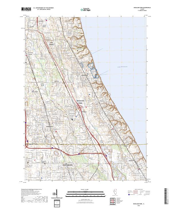
Loading map...2024 Map of Highland Park
USGS Topo · Published 2024About this map
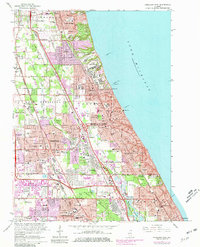
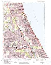
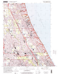
The suburban North Shore of Lake Michigan is intricately detailed in this contemporary study of the residential and military landscape. The prominent presence of Fort Sheridan, including the Fort Sheridan National Cem, stands as a centerpiece along the shoreline between Lake Forest and Highwood. Further south, the map documents the neighborhood transitions within Highland Park, including the distinct districts of Ravinia and Braeside near the Lake-Cook county line.
Find a feature on this map
37 named features on this map. Tap any name to fly to it.
Don’t see what you’re looking for? This feature index may not catch every label — zoom into the map to look around manually.
Map Details
Date Portrayed2024
Date Published2024
PublisherU.S. Geological Survey
Map TypeTopographic
Scale1:24000
Physical Dimensions24 x 29 inches
Editions of this 2024 Highland Park Map
This is the sole edition of this map. No revisions or reprints were ever made.
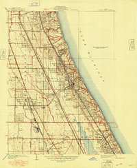
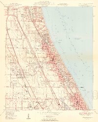
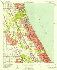
Historical Maps of Fair Meadows Through Time
7 maps found
Featured Locations
- Deerfield, IL
- Lake Forest, IL
- Highland Park, IL
- Glencoe, New Trier Township
- Northbrook, Northfield Township
Source Details
SourceU.S. Geological Survey
CopyrightPublic Domain