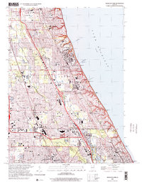
2000 Map of Highland Park
USGS Topo · Published 2001About this map
The North Shore communities of Lake Forest and Highland Park dominate this survey, highlighting the area's transition from historic military and institutional grounds to a dense suburban corridor at the close of the twentieth century. Fort Sheridan stands as a prominent landmark along the Lake Michigan shoreline, situated near the established campus of Lake Forest College. The landscape is defined by the parallel courses of the Skokie River and the branches of the Chicago River, with the Chicago and North Western railway and Edens Expressway providing the primary transit arteries for towns like Highwood and Deerfield.
Find a feature on this map
97 named features on this map. Tap any name to fly to it.
Don’t see what you’re looking for? This feature index may not catch every label — zoom into the map to look around manually.
Map Details
Editions of this 2000 Highland Park Map
This is the sole edition of this map. No revisions or reprints were ever made.
Other maps of this area

1899 · Evanston
USGS Topo · 1:62,500

1900 · Highwood
USGS Topo · 1:62,500

1906 · Waukegan
USGS Topo · 1:62,500

1908 · Waukegan
USGS Topo · 1:62,500

1927 · Arlington Heights
USGS Topo · 1:24,000

1928 · Wheeling
USGS Topo · 1:24,000

1928 · Highland Park
USGS Topo · 1:24,000

1928 · Evanston
USGS Topo · 1:24,000

1929 · Park Ridge
USGS Topo · 1:24,000

1951 · Highland Park
USGS Topo · 1:24,000
Featured Places
- Northbrook, Northfield Township
- Highland Park, IL
- Lake Forest, IL
- Deerfield, IL
- Glencoe, New Trier Township