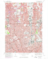
1968 Map of Highland Park
USGS Topo · Published 1974About this map
The industrial and residential expansion of the Detroit metropolitan area is frozen in time on this 1968 survey, showcasing the dense urban grids of Highland Park and Hamtramck. The landscape is defined by the heavy rail infrastructure of the Grand Trunk Western and the Detroit Terminal, which shaped the placement of factories and worker housing during the city's automotive height. Large green spaces provide a sharp contrast to the surrounding development, notably the wooded grounds of Palmer Park and the expansive Forest Lawn Cemetery.
Find a feature on this map
117 named features on this map. Tap any name to fly to it.
Don’t see what you’re looking for? This feature index may not catch every label — zoom into the map to look around manually.
Map Details
Editions of this 1968 Highland Park Map
4 editions found
Other maps of this area

1905 · Detroit
USGS Topo · 1:62,500

1905 · Grosse Pointe
USGS Topo · 1:62,500

1908 · Rochester
USGS Topo · 1:62,500

1912 · Mt Clemens
USGS Topo · 1:62,500

1918 · Detroit
USGS Topo · 1:62,500

1918 · Grosse Pointe
USGS Topo · 1:62,500

1924 · Detroit
USGS Topo · 1:62,500

1929 · Mt Clemens
USGS Topo · 1:62,500

1934 · Detroit
USGS Topo · 1:62,500

1936 · Warren
USGS Topo · 1:31,680