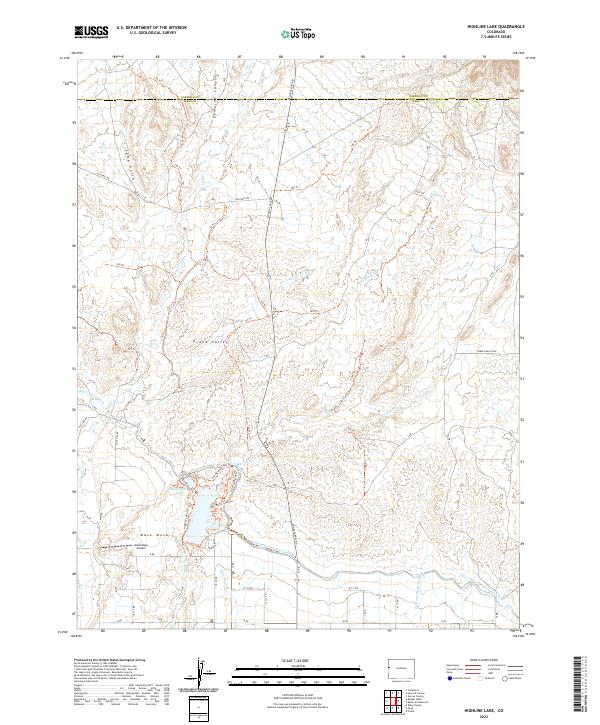
2022 Map of Highline Lake
USGS Topo · Published 2022About this map
Highline Lake and the Government Highline Canal dominate the southern landscape of this portion of the Grand Valley, illustrating the complex water management systems essential to agriculture in the Colorado high desert. The small settlement area of Mack Mesa sits just south of the Mack Mesa Airport, where the terrain transitions from irrigated lowlands to the dissected uplands of Demaree Canyon and Camp Gulch. The map reveals a dense network of recreational paths and local access roads, including the Greasewood Flats Trl and East Bluffs Loop Trl, which navigate the mesas and bluffs. Drainage patterns are defined by numerous seasonal waterways like Salt Cr, Reed Wash, and Coyote Wash, which flow southward toward the valley floor, carving out the rugged topography that characterizes the border between Garfield and Mesa counties.
Find a feature on this map
56 named features on this map. Tap any name to fly to it.
Don’t see what you’re looking for? This feature index may not catch every label — zoom into the map to look around manually.
Map Details
Editions of this 2022 Highline Lake Map
This is the sole edition of this map. No revisions or reprints were ever made.
Other maps of this area

1956 · Grand Junction
USGS Topo · 1:250,000

1959 · Grand Junction
USGS Topo · 1:250,000

1960 · Grand Junction
USGS Topo · 1:250,000

1962 · Grand Junction
USGS Topo · 1:250,000

1962 · Fruita
USGS Topo · 1:24,000

1962 · Mack
USGS Topo · 1:24,000

1964 · Grand Junction
USGS Topo · 1:250,000

1965 · Grand Junction
USGS Topo · 1:250,000

1968 · Badger Wash
USGS Topo · 1:24,000
1968 · Carbonera
USGS Topo · 1:24,000