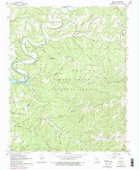
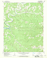
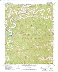
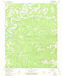
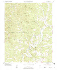
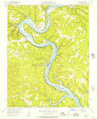
1967 Map of Hilda
USGS Topo · Published 1975About this map
Bull Shoals Lake defines the western edge of this terrain, where the impounded waters of Beaver Creek meet the winding Long Creek. Located in the heart of the Mark Twain National Forest, the small community of Hilda serves as a central point between prominent landmarks like Lower Pilot Knob and Johnson Bald. The landscape is a complex network of ridges and hollows, including Blair Ridge and Lime Kiln Mountain, which historically dictated the placement of small rural institutions.
Find a feature on this map
44 named features on this map. Tap any name to fly to it.
Don’t see what you’re looking for? This feature index may not catch every label — zoom into the map to look around manually.
Map Details
Editions of this 1967 Hilda Map
4 editions found
Other maps of this area

1907 · Forsyth
USGS Topo · 1:125,000

1937 · Bradleyville
USGS Topo · 1:48,000

1943 · Protem
USGS Topo · 1:62,500

1943 · Bradleyville
USGS Topo · 1:62,500

1945 · Harrison
USGS Topo · 1:250,000

1945 · Bradleyville
USGS Topo · 1:62,500

1949 · Harrison
USGS Topo · 1:250,000

1954 · Harrison
USGS Topo · 1:250,000
1955 · Garrison
USGS Topo · 1:24,000
1956 · Mincy
USGS Topo · 1:24,000