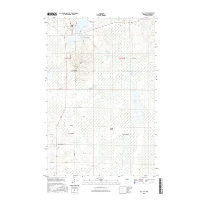
2016 Map of Hill City
USGS Topo · Published 2016About this map
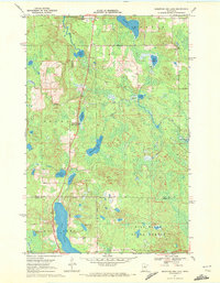
Hill City sits at the northern edge of a landscape defined by extensive wetlands and water management, where the Hill River Ditch and various impoundments like the Willow River Pool and Moose River Flowage dominate the low-lying terrain. This area of Aitkin County is characterized by significant topographic shifts, most notably at Quadna Mtn, which rises above the surrounding marshes. The settlement pattern is anchored by the municipal center of Hill City and the smaller locality of Haypoint to the south. Genealogists will find the locations of Hill Lake Cem and Macville Cem preserved in their geographic context. The presence of the Hill City-Quadna Mountain Airport and numerous local routes like Annie Dagel Rd and Rassier Rd reflect the modern infrastructure supporting this northern Minnesota community. The map also captures the intricate hydrography of the region, from the winding Morrison Brook to the isolated The Big Island within the southern wetlands.
Find a feature on this map
48 named features on this map. Tap any name to fly to it.
Don’t see what you’re looking for? This feature index may not catch every label — zoom into the map to look around manually.
Map Details
Editions of this 2016 Hill City Map
This is the sole edition of this map. No revisions or reprints were ever made.
Other maps of this area

1953 · Duluth
USGS Topo · 1:250,000

1954 · Hibbing
USGS Topo · 1:250,000

1957 · Hibbing
USGS Topo · 1:250,000

1958 · Hibbing
USGS Topo · 1:250,000

1958 · Duluth
USGS Topo · 1:250,000

1964 · Hibbing
USGS Topo · 1:250,000
1970 · Split Hand Lake
USGS Topo · 1:24,000
1970 · Rabey
USGS Topo · 1:24,000
1970 · Big Thunder Peak
USGS Topo · 1:24,000
1970 · Mountain Ash Lake
USGS Topo · 1:24,000