Loading...
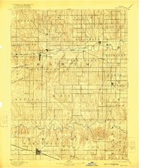
Loading map...1893 Map of Hill City
USGS Topo · Published 1922About this map
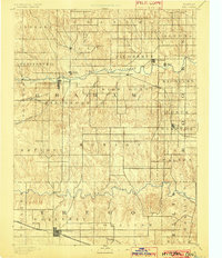
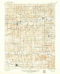
Hill City serves as the focal point of this Graham County landscape, surveyed in the late nineteenth century when the High Plains were transitioning into established townships. The settlement of Nicodemus stands out as a significant historical landmark along the South Fork Solomon River, established by African American settlers during the Exoduster movement. To the south, the Union Pacific Railway corridor defines the development of Wakeeney, anchoring the southern edge of the map in Trego County.
Find a feature on this map
39 named features on this map. Tap any name to fly to it.
Don’t see what you’re looking for? This feature index may not catch every label — zoom into the map to look around manually.
Map Details
Date Portrayed1893
Date Published1922
PublisherU.S. Geological Survey
Map TypeTopographic
Scale1:125,000
Physical Dimensions16.51 x 19.54 inches
Editions of this 1893 Hill City Map
4 editions found

Historical Maps of WaKeeney Through Time
1 maps found
Featured Locations
Source Details
SourceU.S. Geological Survey
CopyrightPublic Domain